

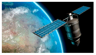
Modern AI can identify forests all the way from space. It can estimate tree heights to an astonishing level of accuracy. It can predict wildfire risk. It can even model ecosystems that have never been surveyed. It is easy to assume these capabilities come from increasingly powerful AI models, and no doubt that is a major component of it. However, the foundation is built from something far less glamorous – it’s the data behind these models.
Raw satellite imagery has to be made AI-ready before it can be of any use. For this to work, scientists often need to collect ground-truth measurements. They may need to merge data from multiple sensors and correct inconsistencies. Various other tasks may need to be performed to build datasets that accurately represent the physical world. These processes are only going to get more challenging as environmental AI becomes more complex. Going forward, we may see the biggest breakthroughs come less from better algorithms and more from better data engineering.
In environmental AI, a big challenge is that no single dataset contains all the information that researchers need. For example, satellite imagery provides broad geographic coverage, but many environmental characteristics must be derived by combining several other complementary datasets.
Each data point is a piece of the puzzle, and that data can be anything from topography and soil composition to historical weather patterns and field observations. All such data can contribute to making the data ready for AI. This is exactly what allows AI to uncover patterns that would be difficult (if not impossible) to detect from satellite imagery alone.
Preparing the dataset is only part of the process. Researchers must use it to train ML models and compare their predictions with data they have, such as new field observations. This helps reveal where the models are accurate and where they still need improvement.
Those findings are folded back into the dataset before the models are trained again. It’s an iterative process. Over time, this cycle steadily improves both the quality of the data and the accuracy of the predictions. This is one of the reasons why environmental AI continues to advance even without major changes to the underlying algorithms.
The scale and complexity of building AI-ready environmental datasets can be seen in a recent collaboration between the U.S. Army Engineer Research and Development Center (ERDC) and the U.S. Forest Service. The joint project aims to create a global framework for predicting forest structure and composition by combining what they say is one of the world’s largest collections of field measurements with satellite observations.
More than 355,000 measured forest plots across the U.S. are being integrated with approximately 17 trillion 30-meter satellite pixels, along with climate, terrain, soil, and other environmental datasets.
The goal is to go beyond simply mapping where forests exist. The goal is to enable AI models to estimate characteristics such as tree species, diameter, biomass, and forest composition in regions that have never been directly surveyed.
The project also demonstrates the scale of the challenge. By combining one of the largest collections of forest inventory data with satellite observations and other environmental datasets, researchers hope to build AI models capable of predicting forest characteristics in places that have never been directly surveyed.
“Think of it like building a high-definition, 3D map of every forest on Earth without having to visit every tree,” said Gabe Powell, a contracted senior research geoscientist. “First, we start with the ‘ground truth’ from those hundreds of thousands of USFS forest inventory plots. Next, we gather terabytes of global environmental data to explain the existence of the structure and composition found at those forest plots.

(NicoElNino/Shutterstock)
“To ensure functionality in access-denied areas, our global explainers come from satellites, which include things like climate, terrain, soil types, and available sunlight.”
The progress made in forestry can be applied to other functions and sectors. We see that the same techniques are increasingly being used to support precision agriculture, infrastructure planning, flood and wildfire prediction, carbon accounting, biodiversity monitoring, and disaster response.
In each case, the challenge is how to transform enormous volumes of raw satellite imagery and environmental observations into datasets that AI can trust.
As satellite constellations continue to grow, collecting imagery is becoming the easy part. The harder part is integrating that imagery with other sources and validating it against real-world observations.
The post How Scientists Are Turning Satellite Imagery into AI-Ready Data appeared first on AIwire.
